
Throughout Cornwall there a huge number of outstanding coastal walks. Whether you are staying in the north or south of the county, every path and trail along Cornwall’s magnificent coastline allows you to explore more of the county’s heritage, natural beauty and amazing wildlife no matter what time of year you visit.
In this guide, we’ll be taking a look at the top 5 most breathtaking coastal walks you can experience when visiting Cornwall. Whether you’re looking for a short afternoon stroll along gentle, sandy seashores or a day trip hiking up cliff paths and taking in the stunning scenery of Cornwall’s dramatic coastline, we’ve gathered a selection of the county’s most beautiful coastal walks so you can enjoy and make the most out of Cornwall’s truly spectacular coastline.
Tintagel to Boscastle
Length: 9 mile circular walk.
Parking: Tintagel Village Car Park.
Ever wanted to walk the lands of myth and legend? Pass through cragged cliffs topped with the ruins of the past and discover hidden harbours nestled in sheltered coves?
Tintagel has been synonymous with legends about King Arthur and his Knights of the Round Table and, although the fabulous medieval ruin perched atop the crags overlooking the village date back to the 13th Century, evidence of a Romano-British presence in the area has fanned the flames of Arthur’s legend amongst locals and tourists alike. The castle marks the start of the walk.
The walk begins with a few steep inclines as you climb the cliffs above the crashing waves below. The path is clearly signposted all along the cliff edge and across the small valleys and coves which make up the first half of the walk. Along the way you will come across Willapark, a place where an Iron Age Cliff Castle and village are once thought to have stood, as well as the small harbour village which goes by the same name and is known as one of the prettiest fishing villages in the UK. As you follow the trail down to Boscastle, lookout for the spectacular outcrop known locally as the Meacharch, a rocky islet which attracts a great number of seabirds to the area and is also home to the phenomena known as Meacharch’s blowhole which may throw up large sprays of sea water as you go by!
Towards the end of the coastal route, the path delivers amazing views of Boscastle, a quaint coastal town with a mysterious history linked to witchcraft and magic. In fact, you can even visit the town’s museum dedicated to the subject if you want to explore more of Cornwall’s mystical past…
Leaving Boscastle, the walk takes a steep path inland towards Cornwall’s beautiful countryside. Winding through country tracks and narrow lanes, the route passes through a number of farms and the gorgeous woodlands surrounding St Nectan’s Glen. If you’re feeling a bit peckish and fancy a classic Cornish cream tea, there is a wonderful tea room here you can visit right next to this ancient site. From this wooded valley, signs to Bossiney, and then Tintagel, will take you back to the walk’s start.
St Agnes to Perranporth
Length: 3.5 mile one way walk (can be made circular via the B3285).
Parking: Parking is available in both St Agnes and Perranporth.
If you’re fancying a short walk with gentle climbs but still want to experience Cornwall’s amazing coastal landscape, then the St Agnes to Perranporth trail is perfect. Starting at Driftwood Spars, a small stroll away from St Agnes itself, you can sample the local tipple at the wonderful brewery which overlooks the sea here.
From here you pass Trevaunance Cove and ascend the steepest part of the walk towards the Blue Hills. Here you can see the remains of old Cornish copper and tin mines as you climb and reach the summit of the cliffs. Keep an eye out for the local grey seals which bob up and down in the turquoise waters and, if you’re really luck, you may spot a dolphin or two!
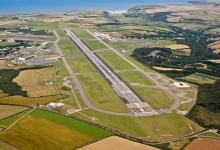
Passing over secret beaches and ancient quarries, the gentle coastal path brings you past the local dynamite works which used to exist here as well as Britain’s best preserved Spitfire base, Perranporth Airfield. Although the airfield now has a much more civilian function, between 1941 and 1946 Perranporth provided a safe landing and refuelling station for 21 different Spitfire squadrons protecting the country during World War Two.
Going past the airfield and following the coastal path further, the walk eventually brings you to a stunning view of the Perran Bay as you round Cligga Head and descend into Perrancoombe, swiftly followed by Perranporth and its amazing beaches. Once you reach Perranporth, there are plenty of places to relax and grab a refreshment (maybe even a sample of the local ice cream on a hot day!) and, if you don’t fancy the walk back to St Agnes along the B3285, there is a bus service which runs between the two.
Porthcurno to Land's End
Length: 5.8 miles one way walk (can be made circular via the B3315).
Parking: Parking is available in Porthcurno and a few sites around Land’s End.
Although it may be a long way away from the rest of the county, the tip of Cornwall presents you with the awe-inspiring views of Britain’s coastal frontier, a stretch of cragged cliffs and wind-swept shores which is teeming with wildlife and natural beauty. This walk begins in the small village of Porthcurno, home to the famous Minak Theatre right by the shoreline. Heading past the spectacular open theatre, you quickly climb the cliffs to then descend down on to the beautiful Porthchapel Beach.
Stretching across the turquoise coastline the beach provides an exquisite place to sit, relax and maybe even dip your toes in the cool waters that lap against the sandy shores. From the beach you meet the path again past St Levan’s Holy Well, a place where locals are once said to have been baptised and is named after the Celtic Christian Saint Selevan (shortened now to Levan). The small cove of Porthgwarra as this location is renowned for sightings of rare birds such as both Dusky and Yellow-Browed Warblers as well as the Red-eyed Vireo.
Following the cliff edge and passing the green fields of Cornwall’s south coast, the trail delivers spectacular views of the crystal blue sea and passes across several breathtakingly beautiful headlands including Gwennap Head. Looking out to sea, dolphins and seals are often seen around these headlands too and, in summer, basking sharks often frequent the deep waters for food.
As you approach England’s most western point you will pass Trevilley Cliff and Pordenack Point where evidence of ancient barrows and a cliff castle have been discovered by archaeologists.
The home stretch to Land’s End, and eventually Trevescan, is a gentle stroll which takes you past the dramatic Enys Dodnan Arch and a cosy pub where you can sate your thirst after the brisk walk from Porthcurno. A bus runs from Trevescan past Porthcurno if you don’t fancy walking back, otherwise you can follow the B3315 through the inner countryside surrounding the peninsula, turning off at Trethewey to get back to Porthcurno.
Mousehole to Lamorna Cove
Length: 5.1 miles circular walk.
Parking: Parking can be found at Mousehole Harbour or a pay and display car park in Lamorna Cove.
Nestled just around the corner from Porthcurno and Land’s End is the tiny harbour of Mousehole (pronounced ‘Mowzel’). This little shipping village is said to have been a landing point for crusaders returning to England during the 12th and 13th Centuries and is the proud home of one of Cornwall’s local delicacies: Starry Gazey Pie. Aside from having a taste of this pilchard and potato pie, if you enter the village in Winter, you may be lucky enough to see Mousehole’s famous Christmas lights which are strangely connected with the dish, as its creator is said to have saved the village from starvation one Christmas during the 16th Century!
Take a lane inland which eventually brings you to a path passing across the rolling fields surrounding the area. Through a few farms and past a couple of cottages, you come to a beautiful forested area which, after a long trek, takes you to Lamorna Cove. Here you can see the breathtaking scenery and coastal views which have inspired film-makers, artists and writers, including the late Rosamunde Pilcher.
Turning into Lamorna Cove, you take a long walk down to the rocky beach which marks the end of the cove before climbing up a slope towards the cliff tops of the Kemyel Crease Nature Reserve. Heading across the beautiful cliff-top nature reserve, you can truly take in the awe-inspiring views presented here as the waves crash against the rocks below and cool sea breeze flows by.
Eventually the path brings you to a most intriguing part of the walk known as Point Spaniard. This area of the coast gained its name due to playing host to a small Spanish invasion during Elizabethan times. The story goes that a Spanish captain called Carlos de Amésquita landed here in 1595 and destroyed Mousehole before sailing to Penzance and burning the fort there too!
After a short while the path will join a lane which will take you back to Mousehole Harbour where you can find plenty of places to sit back and have a well-earned drink and, if you fancy, some homemade Starry Gazey pie!
The Lizard Peninsula
Length: 8 miles circular walk.
Parking: National Trust car park next to Lizard Lighthouse as well as one at Kynance Cove.
Lizard Point on the Lizard Peninsula is England’s most southerly point and is also home to some of the country’s most beautiful landscapes and coastal views. Infamous for its sharp rocks and treacherous waters, Lizard Point has become synonymous with shipwrecks and the evocative names of its dangerous sea rocks.
Taking a right at the lighthouse, you will pass through the lovely meadows of Pistol Ogo and see the infamous Stag Rocks. Walking over the cliff tops you will see the large jagged formations of Barges Rock, Man of War and Shag Rock before turning over the headland towards Kynance Cove which stretches out before you in a vista of windswept crags and towering rock faces.
Past Holseer Coveand the Crane Ledges, you will find a few steep descents and climbs as you make your way into the Lizard National Nature Reserve which passes over Pentreath Beach. From here, on a clear day, you may be able to spot Land’s End in the distance and a few seals may pop up to say hello as you pass Lion Rock and enter Kynance Cove.
Turning left at this charming valley and the islet known as Asparagus Island, you gradually climb inland through the Lizard Downs. As you leave the Nature Reserve, you’ll find the path takes you further inland across a number of fields before leading you towards the little fishing village of Cadgwith near the chillingly named Devil’s Frying Pan, a natural rock formation that has the appearance of cauldron opening out to the sea via a tall sea cave. From here you take the path past Carn Barrow and Whale Rock, following the stunning coastline as it gently climbs towards Bass Point. However, watch out for the steep coves which feature on this stretch of the coast as they can be quite a hike!
Eventually the route will bring you past the disused Victorian Lifeboat Station at Kilcobben Cove and up to the small Lloyds Signal Station at Bass Point. Turning around this clifftop, you then descend into Housel Bay where you can see the large collapsed dip known as the Lion’s Den on the opposite hillside. With one last climb, your path takes you past the Lion’s Den and then back round to the Lizard Lighthouse.
More Information
We hope you have enjoyed our guide to the most breathtaking coastal walks in Cornwall and that we have sparked an urge in you to go out and experience these wonderful coastlines for yourself! These areas of exquisite natural beauty can only really be done justice by seeing them with your own eyes and, with this handy guide in your possession, you’ll certainly appreciate Cornwall’s stunning views and coastal vistas in a way you would have otherwise never had known.
If you want to visit Cornwall and see its amazing coastal landscape for yourself, why not take a look at Cornish Cottage Holidays. Fly to Cornwall Airport Newquay from Airports around the UK and Ireland including London Heathrow, Southend, Manchester, Birmingham, Leeds-Bradford, Belfast, (with Flybe) Dublin, Cork (with Aer Lingus) and more.


Land's End
Tintagel Castle
Land's End